

The “UPPER-CITY”:
Urban computations for the formulation of zoning paradigms from the top-down.
the underutilized urban level
Location: Chelsea, NYC Competition: 2012

This research is the natural evolution of TRA’s work experience history, which deals mainly with unique, almost undevelopable New York City sites and with the new reality of the diminishing available building plots.
Since our work has been primarily new buildings and additions within established historic districts, we found ourselves having to explain the logic of our intervention repetitively to various audiences. This demanded that we proofed and supported our design approach with multiple readings of the urban fabric and the underlying applicable regulations.
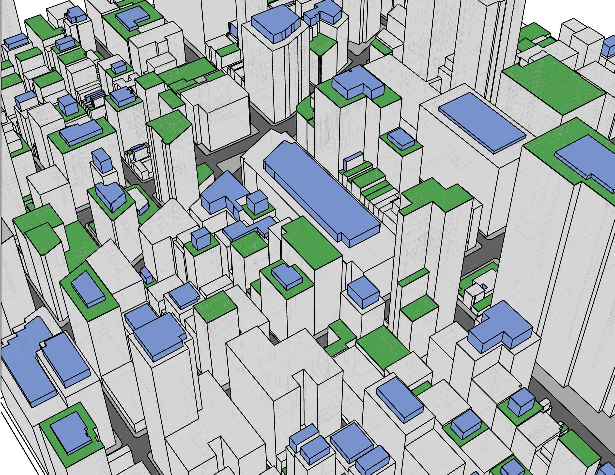
To support our design strategies we developed a three-dimensional model of the city which offers instant visual feedback and takes the many parameters, key data and variables into account. The model provides pluralistic, selected layered readings. Such a computational approach acknowledges the interaction among the natural environment and individual building systems, seeking to improve the performance of each, supporting analysis that until recently, would have taken extensive research and months to be formulated.
Soaring property values and space shortage spur developers to build vertically, often above the already completed city fabric, facing architects with the difficult task of designing within a set of regulations that have not been formulated for the unique sites that are remaining or for the development of the space above the existing fabric.
If the city is almost completely built, should we look at the other half, at the “layer above” with the same set of regulations that have been written from the bottom up or with new guidelines written from the top down? Should there be an integrated creation of new regulations, to sustain the symbiosis with the natural environment, promote the sharing of energy and address the unique and expanding urban landmark districts?
With this study we are investigating a targeted zoning strategy that would look at the city development by regulating the interaction between a two layered environment, where the uses, density and regulations may be different and may provide additional bonuses for the implementation of optimal building strategies.
The design and consulting tool we are developing, is intended for city projects at any scale, acknowledging that all can have a constructive effect on our environment.
Summarized here are several avenues for its use, from the small scale and practical to the speculative and large:
AT A SMALL SCALE: unique sites and additions
An interpretative tool to navigate the often contradicting codes and restrictions that govern building envelopes, through the identification of default and alternative typologies.
To assist in the compilation of support and analysis information for supporting the request of zoning variances for unique sites
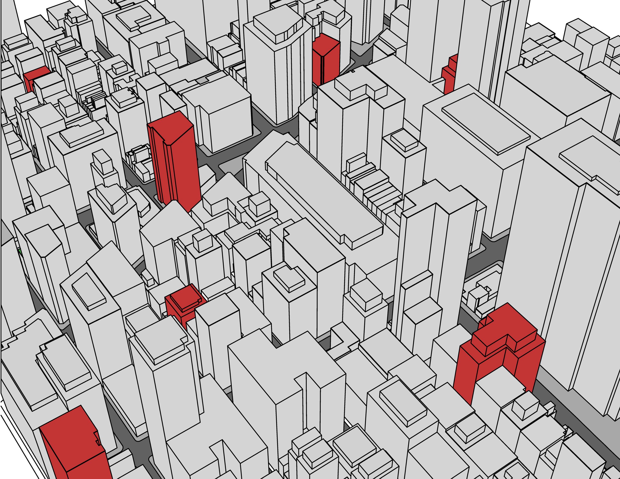
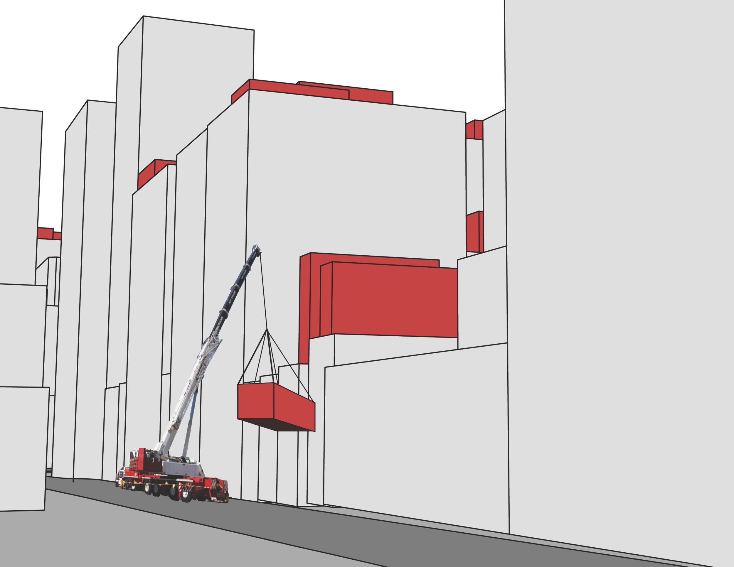
To support opportunities for the vertical expansion of existing structures, for example, identify buildings with optimal conditions, (such as elevators reaching the roof level) for development of prefab penthouses and lightweight temporary structures that can be assembled and disassembled in different locations. Building above the rooftops means dealing with a sense of freedom, where independent design (from the structures below) and new zoning and landmarks regulations should be found. Existing regulations are typically written for the main base buildings. Analysis of shadows for facade optimization for maximum solar energy gain, particularly in regard to building additions.
SCALE OF THE CITY: tall structures
New York City zoning has shaped and shapes our buildings with multiple setbacks that can offer opportunities for addressing climate change in the retrofit of existing structures, emphasizing a symbiotic relationship between the built and natural environments.
Our urban model can identify set-back roof areas to take advantage of the towers’ height, to install green roofs, to reduce storm water runoff, improve insulation and help mitigate the urban heat island effect. Solar hot water panels installed on the green roofs can contribute to the rooftops landscape and augment the building systems.
A map of the geothermal properties of the individual sites would add to the development of new guidelines for sustainable development.
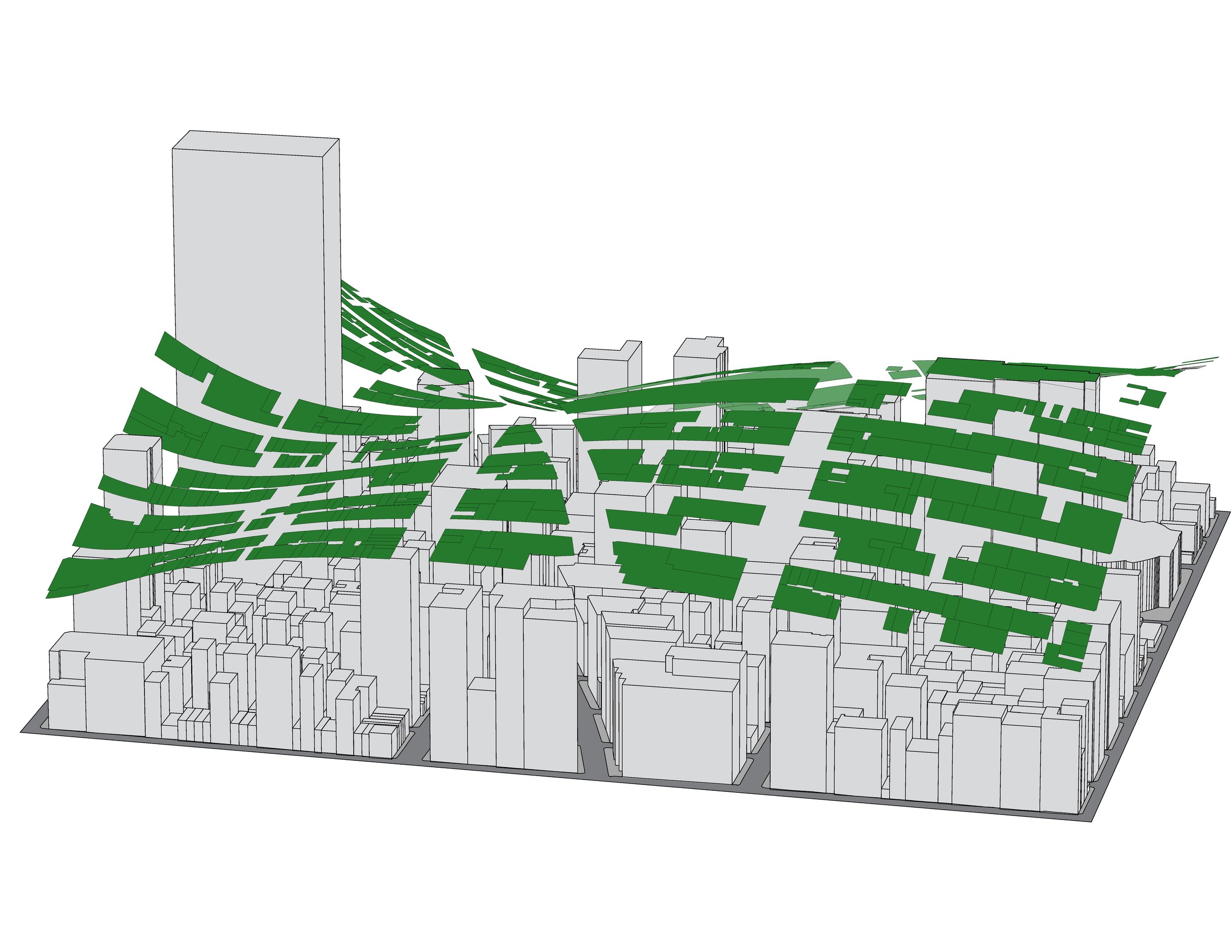
The city model and the information embedded can also be used for the development of a wind power city grid identifying optimal wind routes for energy production as well as cooling of tall buildings. Wind can penetrate tall structures, cooling the buildings, as well as shape public space within, such as sky-lobbies. Zoning bonuses could be provided for implementation of these sustainable programs.
Zoning bonuses could be provided for implementation of these sustainable programs
Finally the identification of sites with urban growth catalysation potential and the regulation of potential block to block aerial connections could be considered to reduce congestion o